"Bloody hell, it's cold init," will no doubt be echoed up and down the country today, with temperatures plummeting as we head into the festive period.
And it's only going to get colder as the Met Office has issued Brits with a snow warning, starting from tomorrow (30 November).
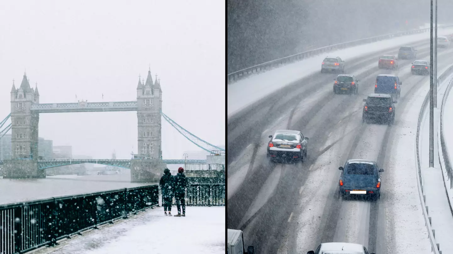
Last night (28 November), temperatures plunged as low as -7.2C as parts of Scotland, Northumberland and Yorkshire have already been hit with snow.
Advert
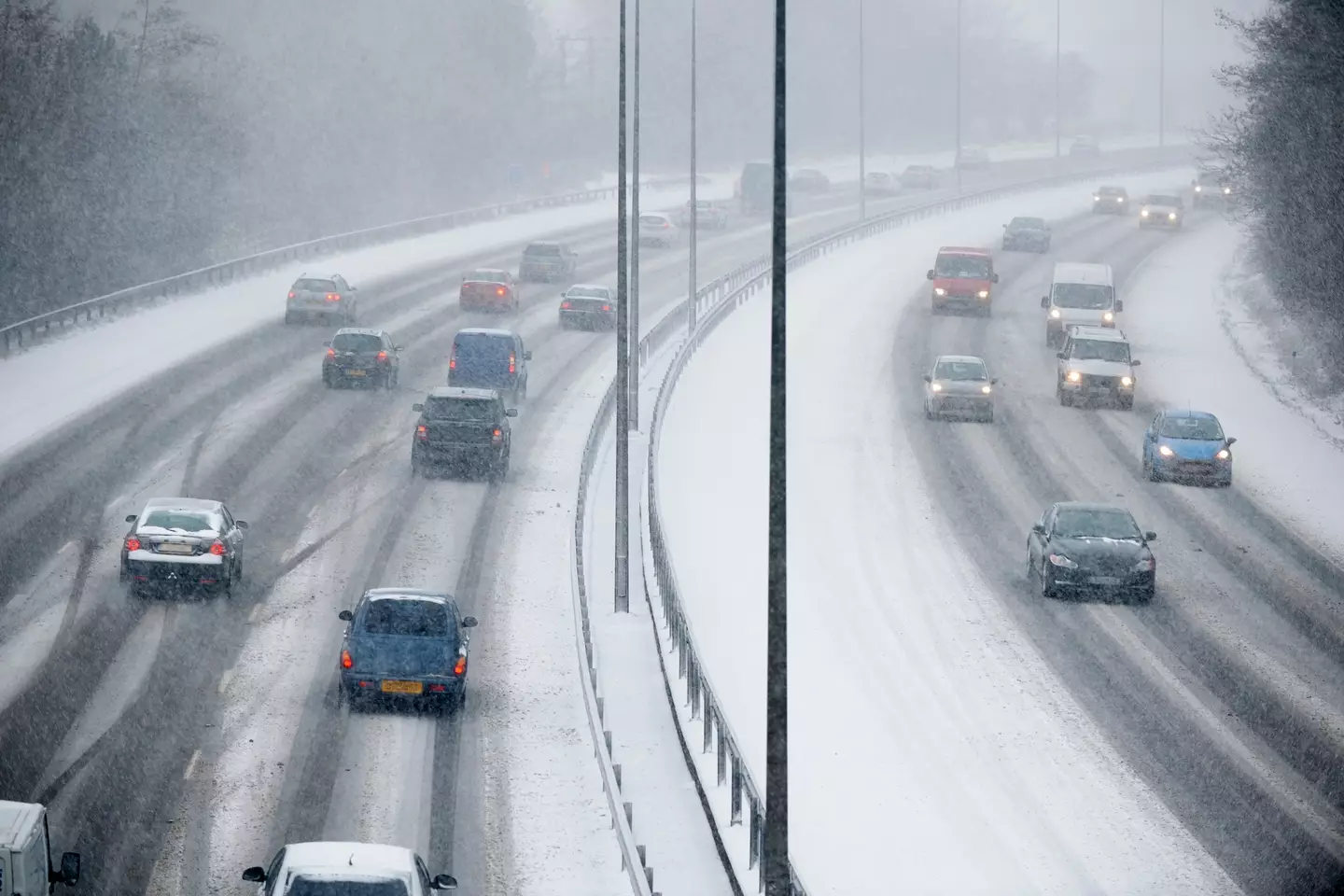
The rest of the UK are now being warned to brace themselves for more snow and ice, amid the plummeting temperatures.
Daytime temperatures are expected to drop to single-digit figures this week and night temperatures are predicted to stay below freezing for large parts of England and Scotland.
A spokesperson for the Met Office said: "Showers, wintry in places, will continue to affect northern and eastern Scotland and eastern England through Thursday evening and overnight into Friday morning.
"These are likely to fall onto frozen surfaces allowing icy patches to form.
"From approximately the Humber northwards, showers will often fall as snow inland, with up to 2cm possible in places, and perhaps as much as 5cm over high ground.
Advert
"Further south, any snow accumulations are more likely to be restricted to higher ground."
They added: "Spells of snow may develop over hills, especially parts of Bodmin Moor, Dartmoor, Blackdown Hills and Exmoor during the early hours of Thursday before petering out later in the day.
"The highest parts of Dartmoor and perhaps Bodmin Moor may see 5-10cm of snow with some drifting in strong easterly winds.
"Elsewhere, accumulations are likely to be relatively small, perhaps 1-3cm at most, and mainly in areas inland and above 100-200m. In addition to this, icy patches may also develop on untreated surfaces."
Advert
Now, this is where it gets interesting as Ladbrokes’ latest betting odds for snow to fall anywhere in the UK on Christmas Day are 1/2.
They predict that Edinburgh and Newcastle are the 'most likely destinations to see snow'.
But before you get excited, the Met Office has urged people to take this prediction with a 'pinch of salt'.
Advert
Met Office spokeswoman Nicola Maxey said: “Christmas is still a month away, so it is impossible with this lead time to have any confidence in a detailed forecast.
“There is often a fine line between who sees snow and who sees rain. Sometimes just a fraction of a degree Celsius change in temperature can make the difference between rain or snow falling, making forecasting snow weeks in advance extremely difficult.
“The definition of a white Christmas most widely used is for a single snowflake to be observed falling in the 24 hours of December 25.
“Therefore, snow falls ‘somewhere’ in the UK for more Christmas days than not. But widespread snow falling and lying on the ground is rather more infrequent.
Advert
“For widespread and substantial snow on the ground on Christmas Day we have to go back to 2010.”
Featured Image Credit: Getty Stock Photos