
Featured image credit: RealLifeLore
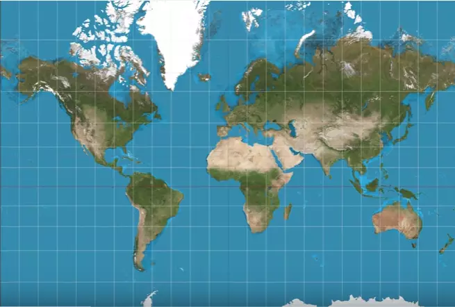
The UK is actually smaller than most people believe because the map of the world we all know and love is based on lies.
Gerardus Mercator created the most well-used map in 1569, which is really impressive when you think about it. But it seems that when he was designing the map, Europe, the US and Russia were all drawn much bigger than they really are.
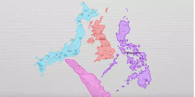
Credit: RealLifeLore
Also, trying to turn a globe into a 2D image would cause some distortions, so we can't totally blame Gerardus.
So, even though the UK looks pretty small on the map, it's actually even smaller in reality.
A video from RealLifeLore used information from The True Size to show us the real size of countries. It shows that little old UK is actually a lot smaller than New Zealand, The Philippines and Madagascar.
It also shows how gigantic some other places are, such as the continent of Africa.
Here's the full video.
Its creators tell us not to be too down on the Mercator map, because it's still great for navigation and for defining the shape of countries.
Advert
Words Claire Reid
Featured Image Credit: